It is not surprising to see most of the travel and mapping companies together with GPS makers jumping into creating smart phone apps for various operating systems. Hiking is such a popular activity these days and enjoyed all around the world by children and adults alike. When it comes to smart phones, the cameras, built-in GPS sensors, and high resolution color touch screens on these devices make them suitable, natural platforms for trail guides, maps, mileage and travel logs, photo taking, social media sharing and trip diaries. Here are some of the best apps for hiking.
Trimble Outdoors Navigator hiking GPS app
This app has a great set of features for hikers including five different maps (aerial, topographic, hybrid, terrain and topographic), a fully integrated GPS and the ability to store and download maps on the device. Therefore, you can use the maps even when out of data or cell phone range. Moreover, the navigator app is very rich in technical features for experienced hikers including the ability to describe, mark and store way-points, a digital compass showing the true and magnetic north, and also the ability to match your UTM coordinates or longitude/latitude to your GPS device or paper mark.
Additionally the guided trips feature helps you follow trips that were recorded by other hikers.
Columbia GPS Pal
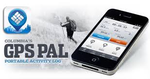
The Columbia GPS app is quite easy to use and even faster to learn. It has an outstanding trip capability which includes the use of videos, photos, and notes to set the GPS tags at selected spots. On the other hand, the app can track and store time, distance, route, pace, elevation and route automatically.
Besides describing and rating events, it can also label and organize events on the Columbia GPS pal website via e-mailed links. The app is also fun to use since users can share tips via Twitter and Facebook and even store data in the app and the Columbia GPS pal site. Moreover, the app has an automatic synchronization with the website account.
My tracks
Google’s my tracks is mainly for android smartphones and it is one of the best hiking apps because it does most of the things expected of a hiking app. My tracks has a nice map and route tracking feature, detailed time, speed, elevation and distance tracking utility, and also the ability to store and upload routes to Google maps.
Moreover, hikers can share via Twitter, Facebook, and Google +. My Tracks stands out mainly because of its suite of connectivity options which include ANT + heart rate monitors, SRM bicycling power meters, and Bluetooth compatible heart monitors. Moreover, My Tracks is perfect for exporting routes to several standard formats including KML and GPX.
MotionX GPS
MotionX GPS is one of the oldest GPS apps in the hiking app category. However, to the company’s credit the app has been updating and adding features to the app aggressively and steadily. Motion X is quite popular for its wheel shaped touch screen control panel. This distinctive control panel provides direct access to most of its functions and it is also very easy to use especially for starting and stopping track recording. Other features include record tracks, maps, download and store apps, digital compass, mark way-points, and sharing. The app can also be used for providing live updates on the position of the hiker.
With the best apps for hiking, your phone can be a true asset on your next hike.


